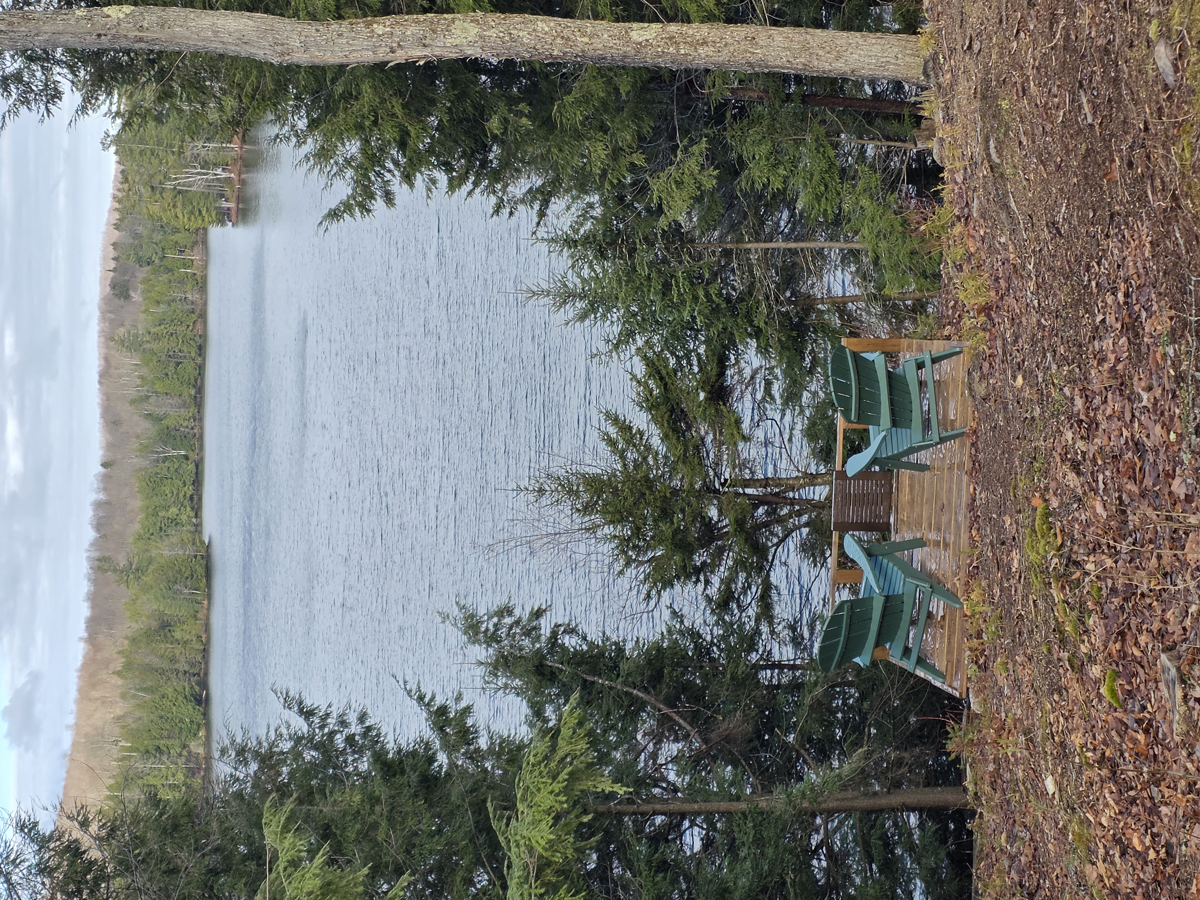
Lattice and Lead
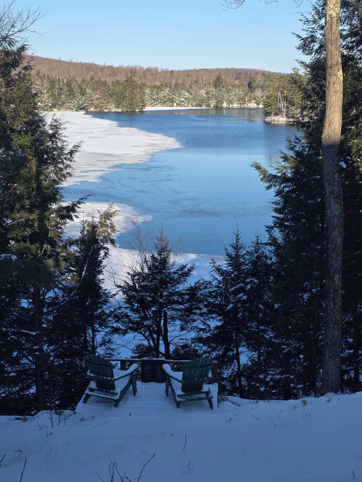
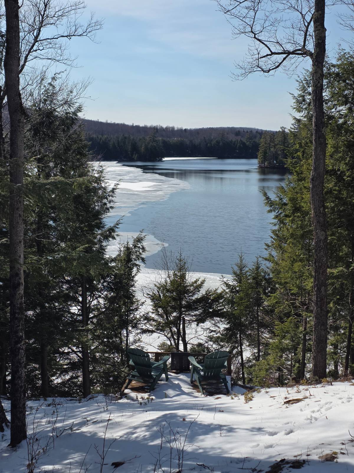
The transition from static winter lattice to active hydrologic movement had begun. Thermal failure was concentrated at the basin connection between the spring-fed basin and the main pond, where the first open lead appeared through the ice field.


The Breach
The first lead did not open across the entire pond. It appeared where the system was already weakest: the connection point, the throat between basins, the place where water movement keeps working beneath the visible lock.
The lead measured roughly six to ten feet across. Margins were softening. Surface integrity was failing. Ice accretion had ended. Decay had begun. Flow was visible again.
- Ice accretion: Absent
- Ice decay: Present
- Surface flow: Present
- Lead formation: Present
Lattice / Lead
Lattice is the winter structure before failure: a locked crystalline sheet holding surface, weather, and temperature in temporary suspension.
Lead is the visible breach: open water through the ice field, a channel where surface tension has failed and the column begins speaking through the margin again.
Margin Condition
This was not full ice-out. It was the beginning of negotiation. The pond had not surrendered winter, but the edge had stopped obeying it completely.
In the Ledger, that matters. The first breach is not scenery. It is a timestamp from the margin, a record of when hidden movement finally becomes visible.
The surface remained locked until the narrows proved otherwise.
LATTICE AND LEAD: SNOW OVER OPEN WATER
DATE: LOCATION: THE PLACE / UPPER POND
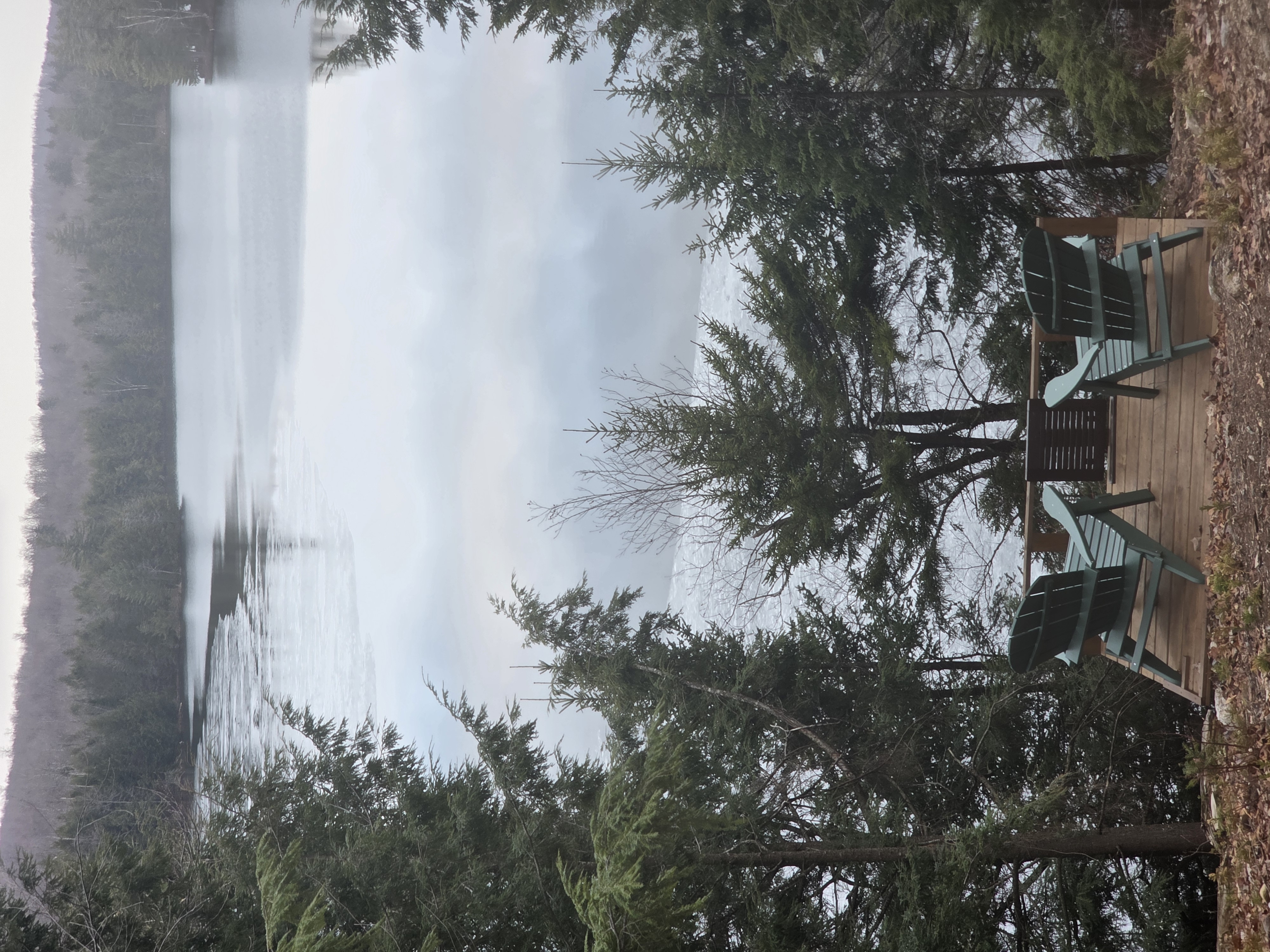
A two-inch snow load settled over the pond after a 19°F night.
It looked like winter had tried to return, but the open lead held. The ice did not knit itself back together. The cold was sharp enough to whiten the surface, but not strong enough to rebuild the sheet.
By morning, the record was plain: snow present, ice retreat still active, open water still dominant.
The pond had crossed a threshold. The night could dust it, but not reverse it.
FIELD RECORD: Ice decay active.
EVIDENCE: Two-inch snow over the littoral zone; open lead still present after 19°F overnight low.
CERTAINTY: Observed from Station Alpha.
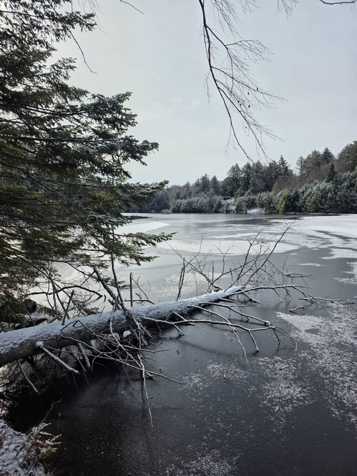
ICE OUT: CANDLED EDGE
DATE: LOCATION: THE PLACE / UPPER POND
The central floe was still white from a distance, but its edges had gone ragged. Near shore, the ice had turned dark and vertical-grained — candled, honeycombed, no longer one solid plate.
The forecast called for a hard thermal push: highs climbing from the low forties toward the sixties within two days. That mattered less as prediction than as pressure. The surface was already failing.
Wind ripples worked the ice from the side. Sun worked it from above. Stumps rising through the water held dark melt rings around their bases, each one a small heat sink.
A conifer trunk remained pinned along the bank, another piece of leverage waiting for water level, wind, and thaw to finish the break.
FIELD RECORD: Shoreline ice failure active.
EVIDENCE: Candled near-shore ice, ragged floe edge, melt rings around organic protrusions, pinned shoreline trunk.
CERTAINTY: Observed from Station Alpha.
NOTE: Brook trout presence could not be visually assessed under ice and turbidity; do not treat as absence from the pond.
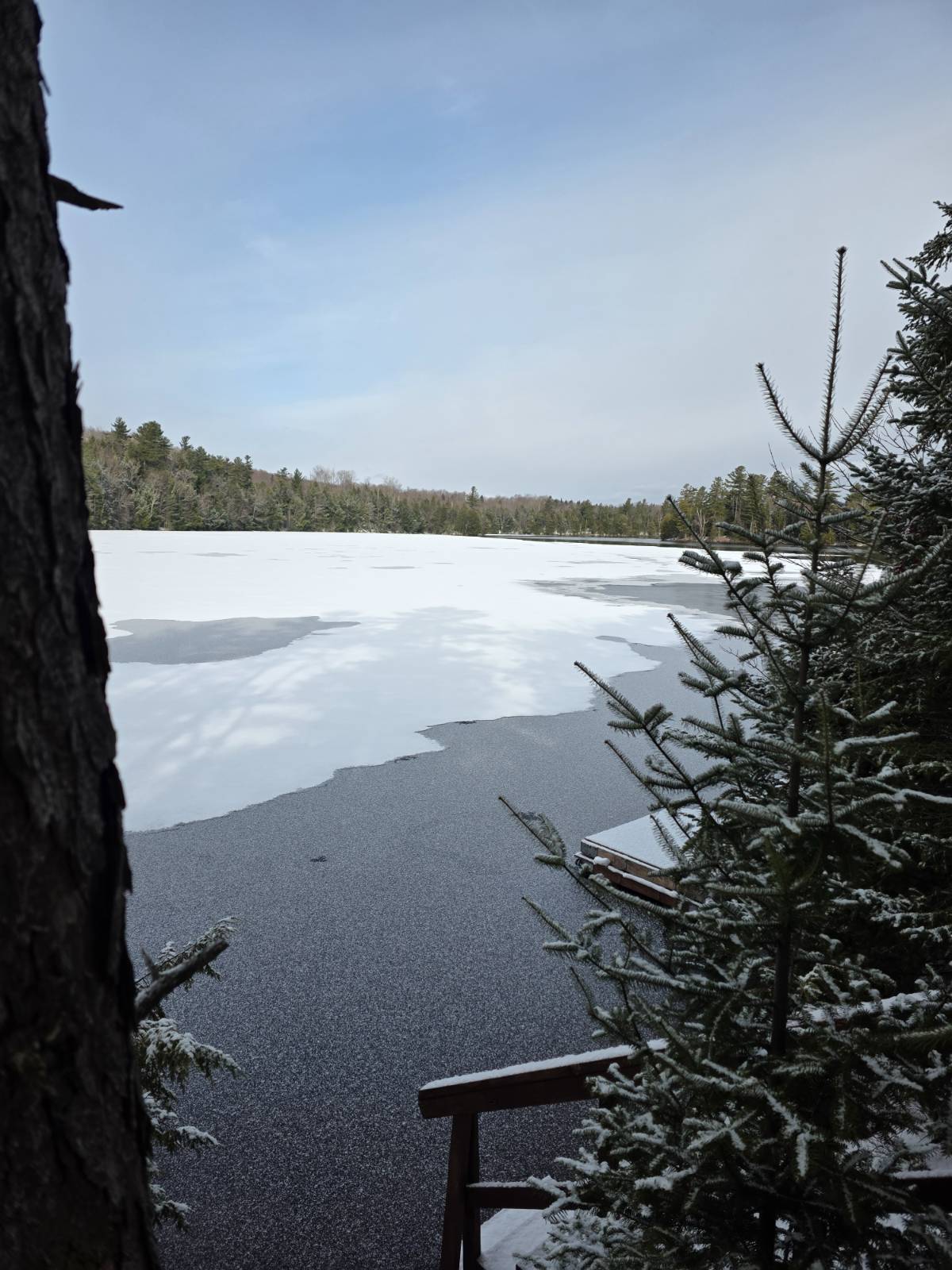

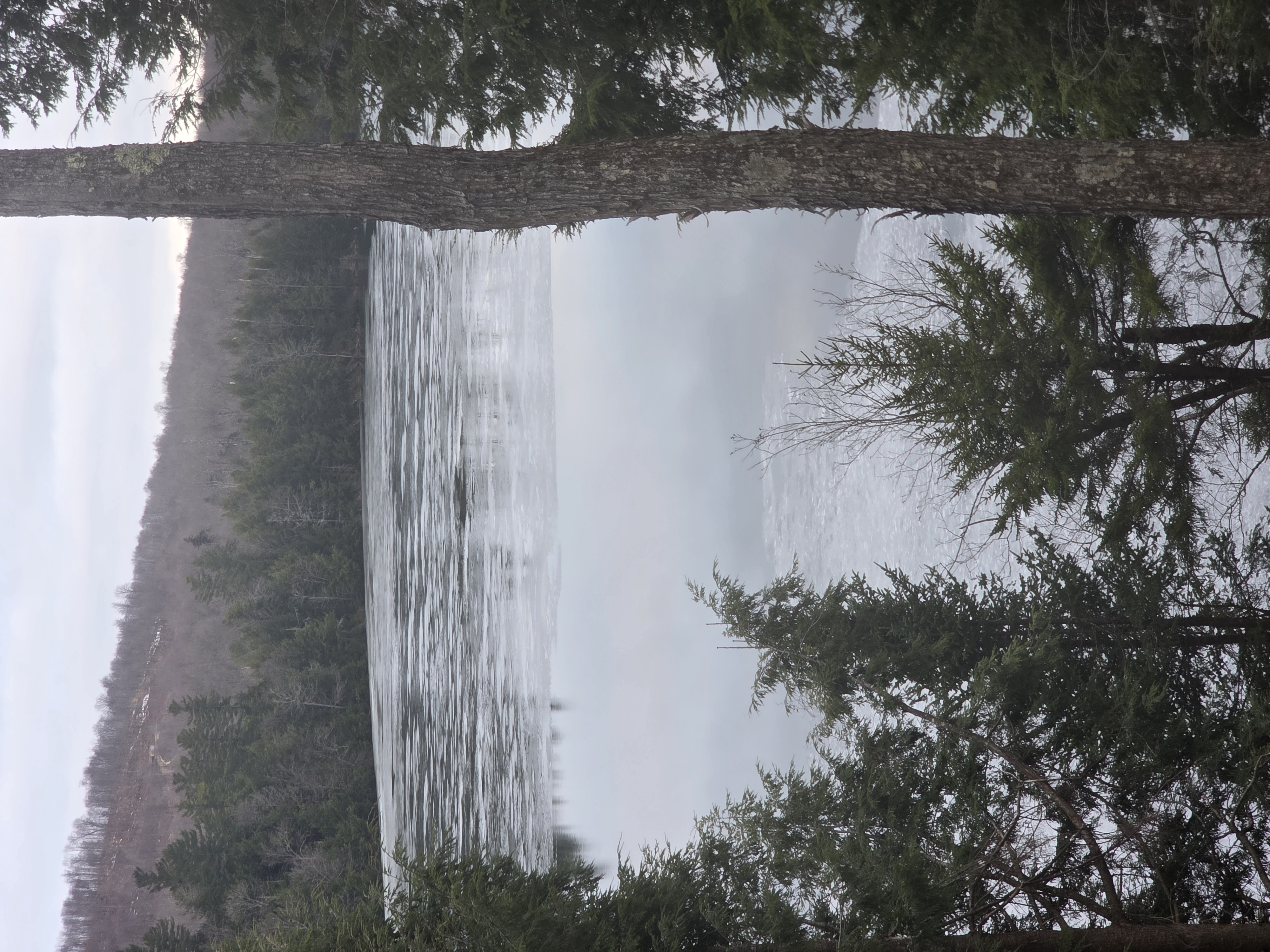
MIDDAY RECESSION
DATE: LOCATION: THE PLACE / UPPER POND
By midday the overnight snow was already being stripped from the pond surface.
The 19°F low had not rebuilt the lead. Sun did the opposite. It thinned the white cover, exposed the darker ice beneath, and pushed the retreat toward the western margin.
The morning looked like a pause only if read from a distance. Up close, the direction was still one way.
FIELD RECORD: Ice decay accelerated.
EVIDENCE: Solar gain removing snow load; open lead still present; lattice recession continuing.
CERTAINTY: Observed from Station Alpha.
DARK ICE
DATE: LOCATION: THE PLACE / UPPER POND
The remaining lattice darkened overnight.
From shore, the retreat looked briefly stalled, but the color told a different story. The white ice had taken on water. It was no longer reflecting light as a solid sheet. It had become dark, rotten, and low in strength.
The snow from two days earlier was gone as a working force. Warmth had entered the structure from within and above.
The final clearance was no longer a question of whether the ice would fail. It was only a matter of when the weakened sheet would finish collapsing.
FIELD RECORD: Terminal ice decay.
EVIDENCE: Dark waterlogged ice; open water dominant; snow load absent.
CERTAINTY: Observed from Station Alpha.
ICE-OUT AT STATION ALPHA
DATE: LOCATION: THE PLACE / UPPER POND
The Upper Pond basin reached full open water at Station Alpha.
The lattice recorded through the previous days had given way. The surface was no longer a mixed field of ice, lead, dark shelf, and snow. From this station, the retreat phase was complete.
This does not claim the same condition for the Spring Pond, Lower Pond, or bog edge. Those places were not ground-truthed in this observation. The record belongs to the Upper Pond basin as seen from Station Alpha.
For this station, ice-out is confirmed.
FIELD RECORD: Ice-out confirmed at Station Alpha.
EVIDENCE: 100% open water at the primary monitoring view.
CERTAINTY: Confirmed for Upper Pond / Station Alpha only.
NOTE: Do not extend this record to unvisited connected waters without separate observation.