
THE SYSTEM ASKED FOR BOATS
The Behemoth, its sidekick, and connected trout water
Date: July 5, 2026
Location: The Place
Type: Field speculation / source-noted reflection
Reader’s Note. This page follows three seasons of Field Scrawl work prompted by the two Indigenous dugout canoes documented at Twin Ponds. The larger dugout is referred to here as the Behemoth. The archaeological study asks why such a large craft would exist on what appears to be a small pond, while also noting that its size and weight suggest repeated long-term use on location rather than transient travel. This page approaches that question from the present water, historical maps, fisheries reports, and field observation. It is a field reflection and interpretation, not an archaeological conclusion.
This is ongoing work. As new field observations, historical records, fisheries evidence, and comparative archaeological material are added, they are being recorded in dated addenda below. Those addenda are a critical part of the page and should be read with the original entry, because they document how the interpretation changes as new evidence is added.
The dugout article asks the question plainly:
“Why create such an enormous craft for use on a pond less than one kilometer wide?”
The archaeological study already offers one important clue. The authors suggest that the great size and weight of the larger Twin Ponds craft indicate repeated long-term use on location rather than mere transient travel. This page begins there and asks a different question: What kind of watershed makes that repeated use not only possible, but expected?
That is the question I carried back onto the water.
I am not answering it as archaeology. I am not proving the use of the Behemoth. I am recording the moment when the question stopped feeling baffling.
Today I wanted to get back toward Little Duck Pond because we had rain, and then sun. Rain disturbs bottom. Sun brings the green back fast. I wanted one more look before letting that earlier page rest.
So I paddled over, checked it, turned, and fished my way back.
At Little Duck Pond, the aluminum rowboat was still there beside the pond. I had passed it before without giving it the weight it deserved. Today it read differently.
Big. Stable. Awkward.
The kind of boat a person hauls in once and leaves because carrying it out each time makes less sense than returning to it. It may now be junk.
But before it was junk, it was a tool.
It was there because someone used that water.
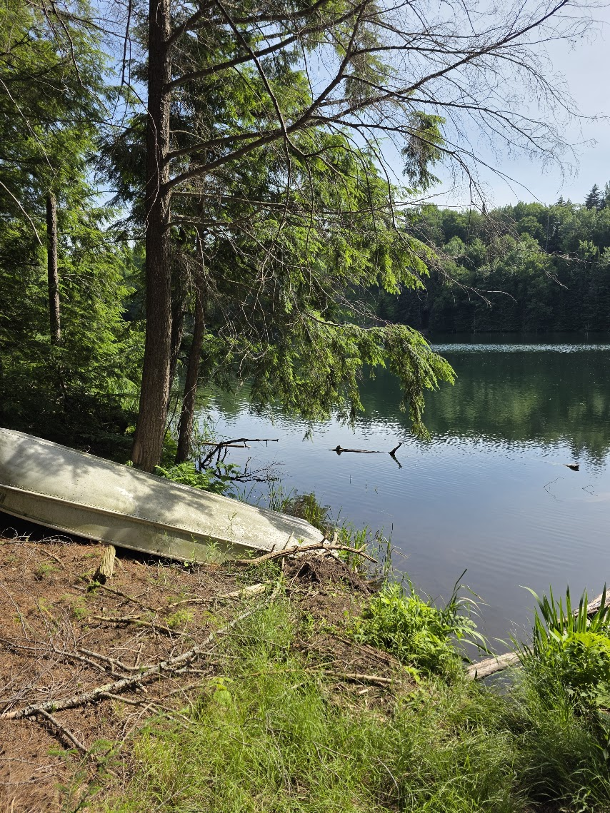
That thought followed me back across the pond.
I was crossing the Lower Pond toward the Upper Pond, trolling deeper water and dictating field thoughts into my phone so I could work them further when I got back. I was thinking about Spring Pond, the Creel, the fishery synthesis, the old Twin Ponds articles, the 1930s camp descriptions, and boats left where water keeps calling people back.
One of those boats was mine.
Because I had been fishing the deeper water for several days, I left my canoe on the dock. It was easier. I could get out without soaking my feet, leave the canoe there, and come back to it. Then the weather turned: fair weather, wind, storms, rain, the usual run of interruption. When I went down again, the canoe had blown off the dock.
Chris and I laughed about it.
Maybe someone will find it five hundred years from now and ask why it was there.
Why was this boat here?
The aluminum rowboat is a modern clue, not the origin of the idea. The pattern is older than Adirondack camps and outfitters: useful water gathers tools. Later settler and private sporting use did not invent that pattern. It intensified it, owned it, sold it, dammed it, stocked it, poisoned it, and left aluminum behind.
The dugouts belong to the older form of the same plain fact.
Working boats belong with working water.
The old USGS map changes the scale of the question.
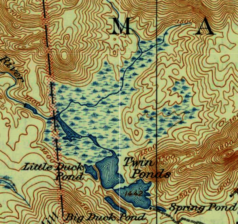
The old Twin Ponds system was not simply one pond less than a kilometer wide. It was a connected water complex. Spring Pond lay connected to the Twin Ponds basin. Upper and Lower Twin were distinct but joined. Fen and channel water carried the system outward.
Put the Behemoth into that map, and the craft no longer feels oversized in the same way.
The fisheries report gives the modern cut line. The present impoundment was created in 1980 by a concrete dam. Before that, the report describes separate waters: Spring Pond, Upper Twin Pond, Lower Twin Pond, and what it calls a 500-acre sphagnum bog-and-channel system with small unnamed ponds.
That is the water I have to imagine behind the water I fish now.
Spring Pond was not a trickle at the head of a map.
Kane’s old account puts a person in a boat over five or six feet of clear water, looking down at white sand and trout moving below. Spring Pond was source water, but it was also boat water — broad enough, deep enough, and clear enough to read from above.
It was not huge.
It did not need to be huge.
It was big enough for a boat.
From there, water fed down toward Upper Twin, the deep cold basin. Other upwellings fed the system. Lower Twin and the fen channels carried the water outward toward the Little Salmon.
From top to bottom, it was fish water, travel water, working water.
A person learning that system and what it gave would not need to ask why a boat belonged there. The system itself asked for boats.
Strip the dugouts from the story for a moment and describe only the place: a clear spring pond over white sand, trout visible from a boat, a deep cold basin below it, large lake trout in that basin, brook-trout water below, fen channels spreading outward, and the Little Salmon leaving the whole arrangement.
Put that description in front of a field person and the expectation changes.
This is not a random pond where a canoe happened to appear.
This is the kind of place where a canoe should be expected.
The dugouts do not make the system strange.
The system makes the dugouts sensible.
The 1933 reporting gives a later private sporting picture of that older arrangement. Upper Twin was described as deep lake-trout water, reaching well toward one hundred feet in places. Ten- and twelve-pound lake trout were not unusual, and fish of twenty pounds or better had been taken. Lower Twin was described as speckled-trout water. Little Duck Pond was brook-trout water. The same account includes Spring Pond, River Pond, East Brook, camps, docks, a boathouse, trails, short carries, and a continuous canoe route through connected waters.
That does not tell me what the Indigenous makers used the Behemoth for.
It tells me the place was connected.
But the image that holds is Spring Pond.
A boat.
Clear water.
White sand.
Trout below.
I know Spring Pond still functions as spawning water now. I have seen brook trout there in spawning mode. The current association rule keeps fishing out of Spring Pond and the Spring Pond–Upper Pond connection. That rule exists because the place is too easy to exploit.
Before that rule, I fished there and caught brook trout one after another. Those were brook trout, not lake trout. I am not claiming proof that the old lake trout used Spring Pond the way brook trout use it now.
But the old arrangement points hard in that direction.
Deep Upper Twin below.
Spring Pond connected to it.
Clear water over pale bottom.
Trout visible from a boat.
Lake trout known to move shallow to spawn.
That is more than idle speculation.
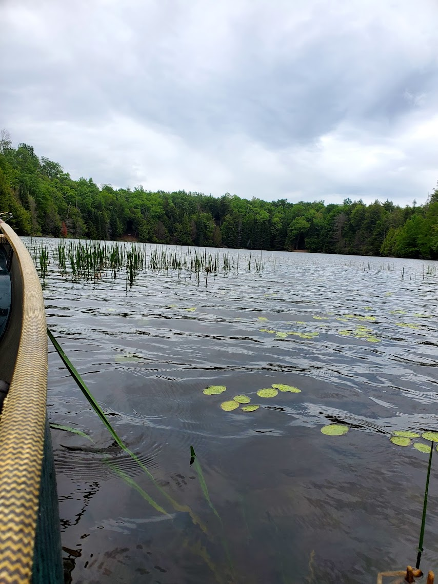
Kane’s old account said five or six feet of water. The old maps are specific: Upper Twin Pond is marked at 1,442 feet, and Lower Twin Pond is marked at 1,443 feet. The post-dam pool information I have been working from places the modern impoundment near 1,450 feet. That calculation adds roughly seven to eight feet of water. The old Spring Pond scene now sits under something like twelve to fourteen feet of modern water. The place is changed, but the logic of the old water still shows through.
Then there is the size of the fish.
Later records describe Upper Twin lake trout large enough to make the labor of a heavy craft easy to understand: ten- and twelve-pound fish in the 1930s sporting account, a fifteen-pounder that Kane said smashed Aubrey’s light trout tackle to fragments, fish greater than sixteen pounds recorded during reclamation, and older catches said to be twenty pounds or better.
A six-meter dugout is not casual work.
A second dugout is not casual work either.
But if large trout could be seen or reached in Spring Pond, the labor changes. Five or six feet of clear water over white sand is not blind fishing. It is readable water. If the fish below were ten-, fifteen-, or sixteen-pound lake trout, the return becomes plain.
Food.
Weight.
Repetition.
A place worth building for.
I do not imagine the Behemoth only as a boat for fishing blind in one hundred feet of water.
I imagine the deep basin as the holding water, and the seasons as the opening. In fall, lake trout move shallow to spawn. In spring, lake trout can rise into the upper water column, where a boat, line, lure, net, or other gear could reach fish that were not sitting on the bottom.
The opportunity was not one moment.
It was the way deep water, clear water, season, and fish movement worked together.
Fisheries sources record lake trout seasonal movement and fall spawning over clean rock, rubble, or boulder bottom in water shallow enough to be approached and read. Science records the pattern. It did not invent it.
Indigenous users did not need a fisheries report to learn when fish moved.
They had seasons.
They had water.
They had watching.
They had return.
If the old Upper Twin lake trout moved into readable water, then fifteen- and sixteen-pound trout were not hidden abstractions.
They were reachable weight.
A fish like that is not a curiosity.
It is food.
It is weight.
It is return.
If later private anglers, preserve owners, and fishery managers recognized those fish as worth camps, trails, boats, docks, boathouses, guide work, stocking programs, dam work, and management, then more likely than not the Indigenous makers recognized the value of the same system in their own way.
Not as sport camp.
Not as property.
Not as a managed fishery.
As food, movement, season, work, and return.
And it was not alone.
The smaller dugout should not disappear into the shadow of the Behemoth. A large stable craft and a smaller craft together make more sense than either one alone. One could hold steady. One could move. One could carry a line. One could work the edge. One could help push or corral fish toward a net, a shallow, a barrier, or the larger platform. In deeper water, the smaller craft could also help set, tend, or retrieve gear while the larger craft carried weight and held position.
I do not know the exact work.
But the pairing itself belongs to use, not accident.
One boat for steadiness.
One boat for movement.
The Behemoth and its sidekick.
Regional museum accounts record Indigenous fishing with hooks and lines, nets, spears, traps, lures, bait, and canoe-based methods. Oneida accounts describe spawning-season corralling, with larger fish taken and smaller fish allowed to pass. People did not come to fishable water empty-handed.
I do not know whether the Behemoth held a spear, a net, a line, or only people watching the water. But a large stable boat and a smaller moving boat beside visible trout water no longer require an invented purpose.
The system was distinct enough to call for distinct tools.
What I know is that I no longer need a separate explanation to make the Behemoth fit the place.
The boat already fits the connected water.
Later settler and private sporting use is easy for us to read. Camps, docks, boathouses, trails, guide boats, trap nets, stocking records, dams, and leftover rowboats all make sense because they belong to a kind of use already documented in the records. Fish were taken. Access was managed. Water was made to serve a purpose.
Indigenous use was use too.
A fish taken from the water is a fish taken from the water. A gathered material is a gathered material. Extraction did not begin with dams, deeds, or rotenone. The difference is not that one people used the place and the other did not. The difference is what later use became: property lines, guide economy, dam, poison, stocking, altered water, and a managed fishery built over the older system.
The map records the old shape. The fisheries report records the cut line.
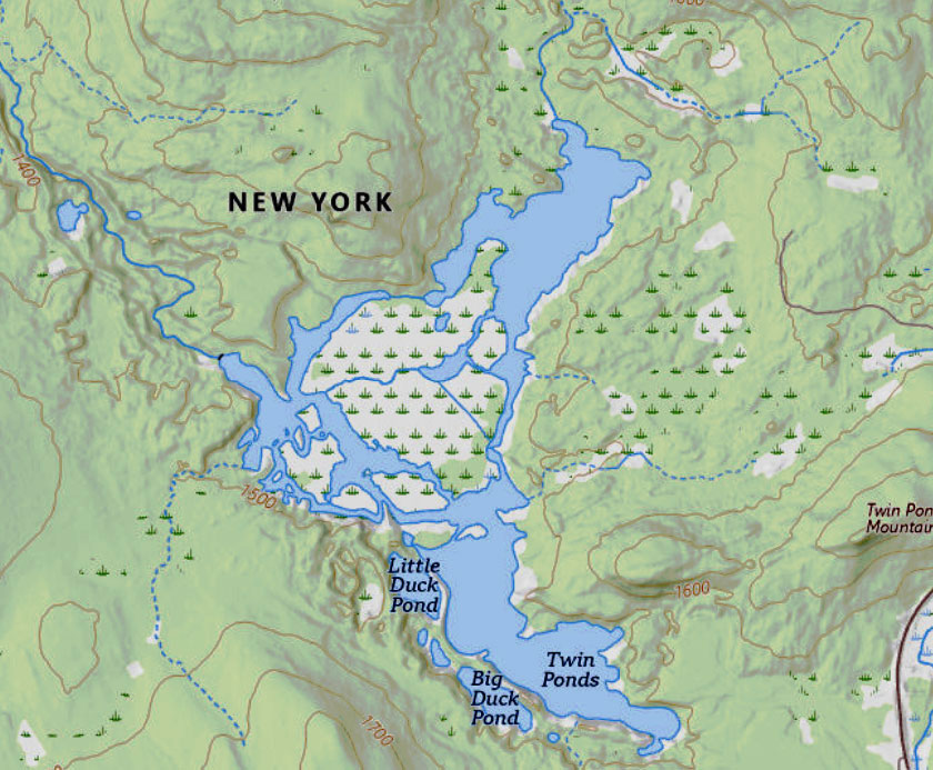
After the 1980 dam created the modern impoundment, the system was treated with rotenone. The fisheries report calls the work “reclamation.” Yellow perch, white sucker, brown bullhead, and minnows were targeted. The same work also eliminated the self-sustaining lake-trout fishery in Upper Twin, with lake trout over sixteen pounds recorded. Brook trout stocking followed. Brandon Fisheries appears in the older management record; New Brandon Fisheries appears in the current reports.
The modern reports add an echo, but not proof. New Brandon Fisheries used modified Oneida-style trap nets at the system’s working points. In fisheries language, that name appears to belong to Oneida Lake sampling gear, not to a proven Indigenous net design at Twin Ponds. Still, the functional rhyme is hard to miss. Modern trap nets use leads, wings, and a trap box to guide fish movement into capture. Oneida accounts of traditional fishing also describe fish being corralled during spawning seasons, with larger fish taken and smaller fish allowed to pass.
Different materials.
Different authority.
Different era.
Same lesson from water: fish movement can be read, guided, and worked.
The word is reclamation.
From the brook-trout management side, I understand the word. Clear the fish judged incompatible. Build the desired trout fishery.
From the older water’s side, the word is harder.
The old system was dammed, flooded, poisoned back, stocked, netted, and remade as a different kind of trout place. That does not make the brook trout false. I fish the result. I add to the Creel. I watch Spring Pond. I catch those fish.
But I do not have to let the management word erase the older arrangement.
That is the complexity that was lost: not just a pond, but clear source water, deep lake-trout water, brook-trout water, fen channel, and outlet all working as one arrangement.
Upper Twin held lake trout.
Lower Twin held speckled trout.
Spring Pond was clear, spring-fed, connected, and visibly alive with trout over pale sand.
The Behemoth and its sidekick sit better inside that older arrangement than inside the small question of pond width.
I cannot say who stood in them.
I cannot say what language they spoke, what season it was, or whether they were fishing, netting, gathering, crossing, waiting, watching, or teaching someone younger how to read the water.
I can only say what changed today from the canoe.
The large dugout was not too large.
The imagined place was too small.
Put the Behemoth back into connected trout water. Put it near Spring Pond, where fish could be seen over pale bottom. Put it near deep Upper Twin, where lake trout once held. Put it near Lower Twin, fen edge, channel, boat, crossing, and return.
And do not leave the smaller canoe out.
Then the Behemoth is no longer a behemoth.
It is a boat.
And it was not alone.
A big boat.
A smaller boat.
Tools left where working water asked for them.
[ Field Addendum ]
Date: August 22, 2026
Location: The Place
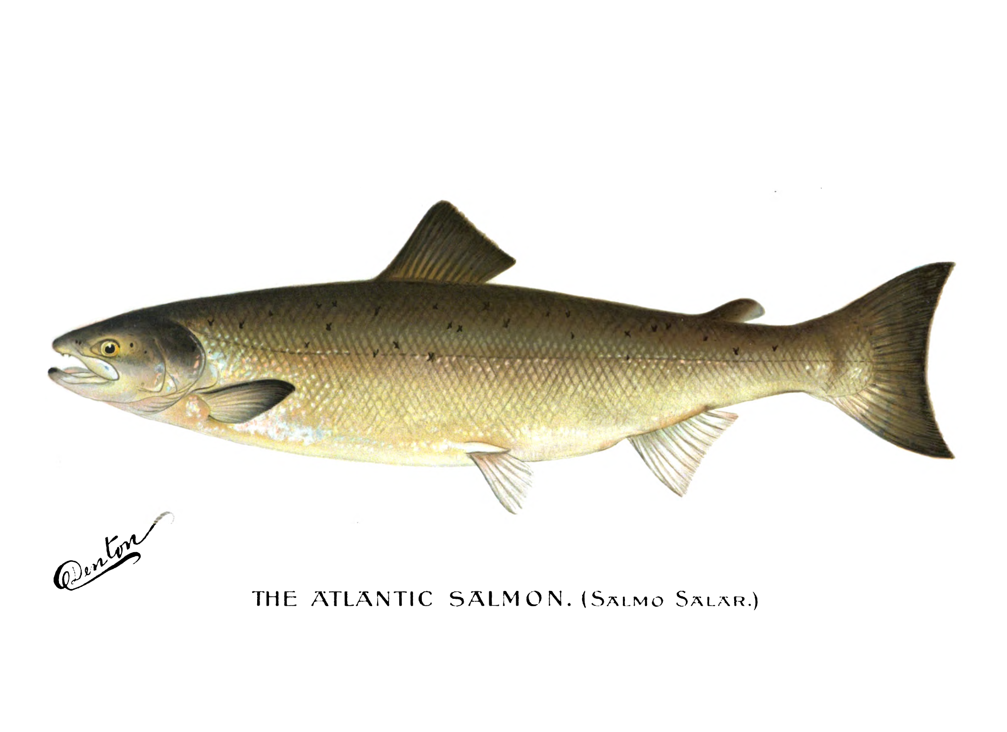
ATLANTIC SALMON, HOLDING WATER, AND THE NARROWS
When I wrote The System Asked for Boats, the fishery I could see most clearly was trout.
That part has not gone away.
Upper Twin supported an exceptional lake-trout fishery. Brook trout occupied other portions of the connected system, including the shallower and spring-fed upper waters. The original page already showed why boats belonged in that fishery.
Atlantic salmon add another part of it.
They also add the scale of a much larger seasonal fishery.
Historical New York accounts record Atlantic salmon catches of four hundred fish in a night, two thousand fish speared in a night, and thirty-six hundred fish taken by twelve skiffs. Those figures come from the historical synthesis Atlantic Salmon in New York and are regional reference conditions, not Twin Ponds estimates.
Those numbers do not describe Twin Ponds.
They establish the extraordinary abundance of the larger Atlantic salmon population from which tributary runs were drawn.
That is what abundance meant.
The question at Twin Ponds is not whether thousands of salmon filled Upper Twin. It is what happened when some portion of that much larger migratory population entered a small connected headwater system where its movement became increasingly confined.
GREELEY AND GREENE
The 1931 New York State Conservation Department survey gives that question a stronger foundation than I understood when I wrote the original page.
John R. Greeley and C. Willard Greene said their annotated list included fishes “known to be present or to have been present” in the survey region. Their survey encompassed the Salmon River system as part of the northern New York St. Lawrence watershed and treated Atlantic salmon as a former member of that regional fauna.
Their summary was direct:
“One species, the Atlantic salmon, is extinct.”
They also described Atlantic salmon as a cold-water species that “was not permanently resident in the St. Lawrence River.”
It moved through the river system.
Greeley and Greene also treated barriers as one of the principal controls on upstream fish distribution. Their regional analysis distinguishes waters isolated by barriers impassable to fish from systems in which St. Lawrence fishes penetrated far upstream where complete natural barriers were absent.
The Franklin County Salmon River, into which the Little Salmon flows, is also identified in later official local-government fisheries history as having once supported runs of Atlantic salmon. The underlying pre-extirpation source for that statement has not yet been recovered, so I treat it as strong local documentation rather than a primary historical observation.
That closes some of the distance between the regional St. Lawrence record and this particular headwater system.
Then there is Wayne Miller.
Miller grew up along the Little Salmon near Brushton and knew the river, its tributaries, springs, dams, and upper watershed over decades. He wrote that he expected salmon had once been in the Little Salmon River.
What makes that observation particularly useful is what he wrote immediately afterward.
He identified Twin Ponds as the place where the Little Salmon rises and described the spring-fed brooks associated with those headwaters as good spawning habitat for salmon and trout. His statement is an informed local inference, not a cited historical salmon record.
His salmon argument did not stop somewhere downstream.
It reached the Twin Ponds headwaters.
The state survey establishes the regional fish and the nature of its movement.
The Salmon River record brings that fish into the drainage receiving the Little Salmon.
Miller brings it onto the Little Salmon itself and follows the river to its source.
The topography now adds another piece.
USGS StreamStats identifies the Little Salmon as a perennial stream and gives a main-channel length of about 14.2 miles. Its 10–85 percent main-channel slope is about 57 feet per mile, with the upper half averaging about 37 feet per mile.
I then ran a longitudinal profile from the lower Little Salmon upstream to the 1980 Twin Ponds dam and separately refined the two steepest-looking reaches.
The full profile showed a continuous ascent rather than a single major vertical break.
The two refined sections did the same thing.
What appeared at coarse scale as potentially troublesome steep reaches resolved into sustained channel gradient and short rapid-like rises rather than an obvious waterfall-scale step.
The sharp rise at the upstream end corresponds to the modern dam area and cannot be treated as evidence of a pre-impoundment natural barrier.
Logging, dams, channel work, and later impoundments mean that a modern profile cannot simply be projected backward unchanged.
But the StreamStats work now gives positive topographic support to what the historical record had already suggested:
The modern profile shows no obvious waterfall-scale barrier on the reconstructed route between the Little Salmon and the Twin Ponds headwaters.
That does not prove salmon passage.
It removes one of the most obvious reasons to reject it.
Atlantic salmon were likely using the Little Salmon River watershed and reached the Twin Ponds headwaters.
Follow that movement upstream and the reconstructed route is:
St. Lawrence River → Salmon River → Little Salmon River → fen and channel system → Lower Twin → Upper Twin → Spring Pond and the spring-fed upper waters.
UPPER TWIN AS HOLDING WATER
One of the most useful pieces of the newer research comes from Atlantic salmon themselves.
At Lough Feeagh in the Burrishoole system in Ireland, tagged wild Atlantic salmon migrating toward spawning grounds above the lake averaged 228 days in freshwater and spent about 90 percent of that time in the lake. They concentrated near the principal inflow leading toward the spawning grounds and moved into deeper, cooler water during thermal stress.
They were not simply passing through.
The study contains no Indigenous fishery and is not being used as a cultural comparison.
Its value is biological.
It establishes directly that Atlantic salmon can use a freshwater lake lying on their spawning migration route as prolonged holding water.
That puts Upper Twin in a different light.
It was already proven cold-water habitat by its lake-trout fishery. Atlantic salmon and lake trout can occupy the same larger cold-water systems while using different portions of that habitat.
Upper Twin was therefore not simply water salmon had to cross.
It provided the kind of deep, cold basin in which Atlantic salmon are documented holding during an upstream migration.
The exact maximum depth is not necessary to the argument. Historical descriptions put it near one hundred feet in places; other estimates are closer to seventy-five.
Either way, it is a very deep, cold basin.
Its value lies in the basin itself—the shelves, cold layers, spring influence, thermal breaks, and connection to the next upstream water.
Salmon entering Upper Twin did not have to continue immediately toward Spring Pond.
They had holding water.
TWO NARROWS
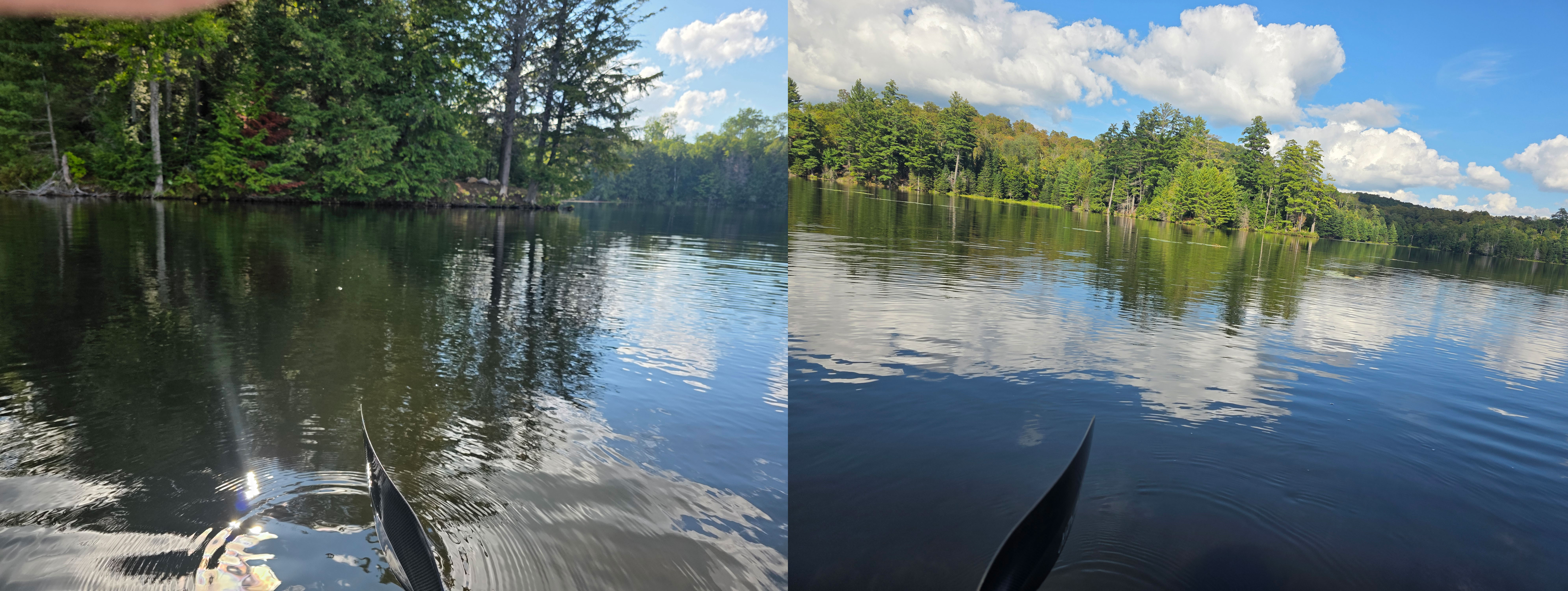
On August 26 I went back to the Lower Twin–Upper Twin connection specifically to look at the old geography.
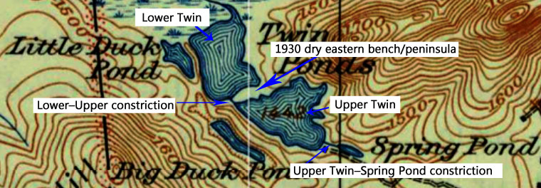
The modern opening now spreads across the drowned eastern shelf and is considerably wider than the old navigable passage.
Within that modern opening, the old deep channel still hugs the western shore.
From the canoe I estimated that deep channel at approximately five to seven yards wide.
I was only several yards from the western bank and could not reach bottom with a standard kayak paddle.
The eastern side is completely different.
There the old landform survives underwater as a broad submerged shelf or peninsula. I could see the substrate and touch bottom with roughly one-half to three-quarters of the paddle.
The 1930 map shows that broad eastern feature as dry land before the later enlargement of the impoundment.
My August 26 observations located that same landform beneath the modern water.
The old connection therefore did not look like the broad opening seen today.
Much of what is now open water on the eastern side was land, leaving the deep navigable passage concentrated tightly against the western shore.
The modern private lean-to on the western side is useful only as a topographic marker. It occupies dry ground immediately above that deep channel.
The old passage was tighter than it appears today.
Farther upstream, the connection between Upper Twin and Spring Pond created another constriction before the spring-fed upper water.
Whatever number of salmon reached the headwaters, the landscape narrowed their movement twice.
WHERE FISH MOVEMENT BECOMES WORKABLE
There are documented Indigenous fisheries organized around exactly that physical advantage.
In the Babine–Nilkitkwa system in British Columbia, salmon fisheries operated at narrow outlets and connections between lake waters. Weirs and traps used those constrictions to concentrate migrating fish. Canoes worked around the structures, and openings could regulate passage farther upstream.
Babine is not Twin Ponds, and its salmon are not Atlantic salmon.
What it demonstrates is the mechanics.
Narrow water does part of the work.
At Mnjikaning, the Atherley Narrows fish-weir complex in Ontario provides an eastern glaciated-landscape comparison. Wooden weirs were repeatedly constructed in the shallow constriction between two lakes over a very long period.
Again, that does not place a weir at Twin Ponds.
It shows why a narrow lake-to-lake passage is valuable fishing geography.
The Twin Ponds question is therefore straightforward.
Salmon moving through Lower Twin toward holding water in Upper Twin encountered a passage already compressed by the land.
Fish later continuing toward Spring Pond and the spring-fed upper waters encountered another.
The size of the run does not have to be known for that geometry to work.
THE BOATS
The original page already deals with the size and labor represented by the Behemoth, so there is no reason to make that argument again here.
What the newer comparisons add is function.
Large dugouts were directly used as salmon-working boats.
On the Harrison River, one remembered dugout was approximately thirty-three feet long—considerably longer than the six-meter Twin Ponds boat—and carried a three-person crew while salmon were speared from the craft.
At Babine, canoes worked around salmon traps and weirs while fish were captured, handled, and moved.
Those comparisons do not assign a function to the Twin Ponds boats.
They demonstrate that large canoes can function as working equipment in fisheries involving open water, constrictions, transport, and processing.
The Behemoth did not need to operate inside the narrowest part of a weir or channel.
It could work Upper Twin.
It could approach the constriction from the basin.
It could carry people and gear.
It could receive catch taken at the narrows.
It could move fish from capture water to working ground.
The smaller dugout does not need a separate invented job.
Two boats are what were recovered.
FIELD STATION AND PROCESSING GROUND
The Lower–Upper constriction now looks to me like a strong candidate for a field station rather than necessarily the location of an entire camp.
It has the things a capture point needs.
Narrow water.
A deep channel.
Dry ground immediately beside it.
A landing.
A place to watch fish movement.
A place to work gear.
Processing a sustained fishery requires something different.
Space.
Firewood.
Fires.
Racks.
Baskets.
Storage.
People working.
The comparative research repeatedly separates constricted capture water from flatter dry ground better suited to handling and preserving fish. Babine is especially useful here because fishing stations, smokehouse/cache evidence, and larger processing or residential areas occurred as differentiated parts of the same fishery.
There are northeastern comparisons for that larger pattern as well.
At Oxbow, Metepenagiag, on the Northwest Miramichi River in New Brunswick, archaeology documents roughly three thousand years of repeated Mi'kmaq occupation at an important fishing locality, including numerous hearths. Atlantic salmon also remained an important food fishery for the Metepenagiag Mi'kmaq.
Metepenagiag is not a population-scale comparison with Twin Ponds. It is useful here for the spatial relationship between a productive fishery, repeated occupation, hearths, and processing ground.
Closer to Twin Ponds, Indian Carry at the southern end of Upper Saranac Lake preserves another part of the pattern: repeated Indigenous seasonal occupation along an Adirondack water route where people gathered to hunt and fish between connected waters.
Neither site tells us what stood at Twin Ponds.
They show that productive fishing and travel locations can become repeatedly used working landscapes, with water access and occupation ground occupying different but connected spaces.
That brings the outlet and fen back into the picture.
And the old fen was not the floating landscape seen today.
Before the 1980 impoundment, it was attached to the surrounding ground.
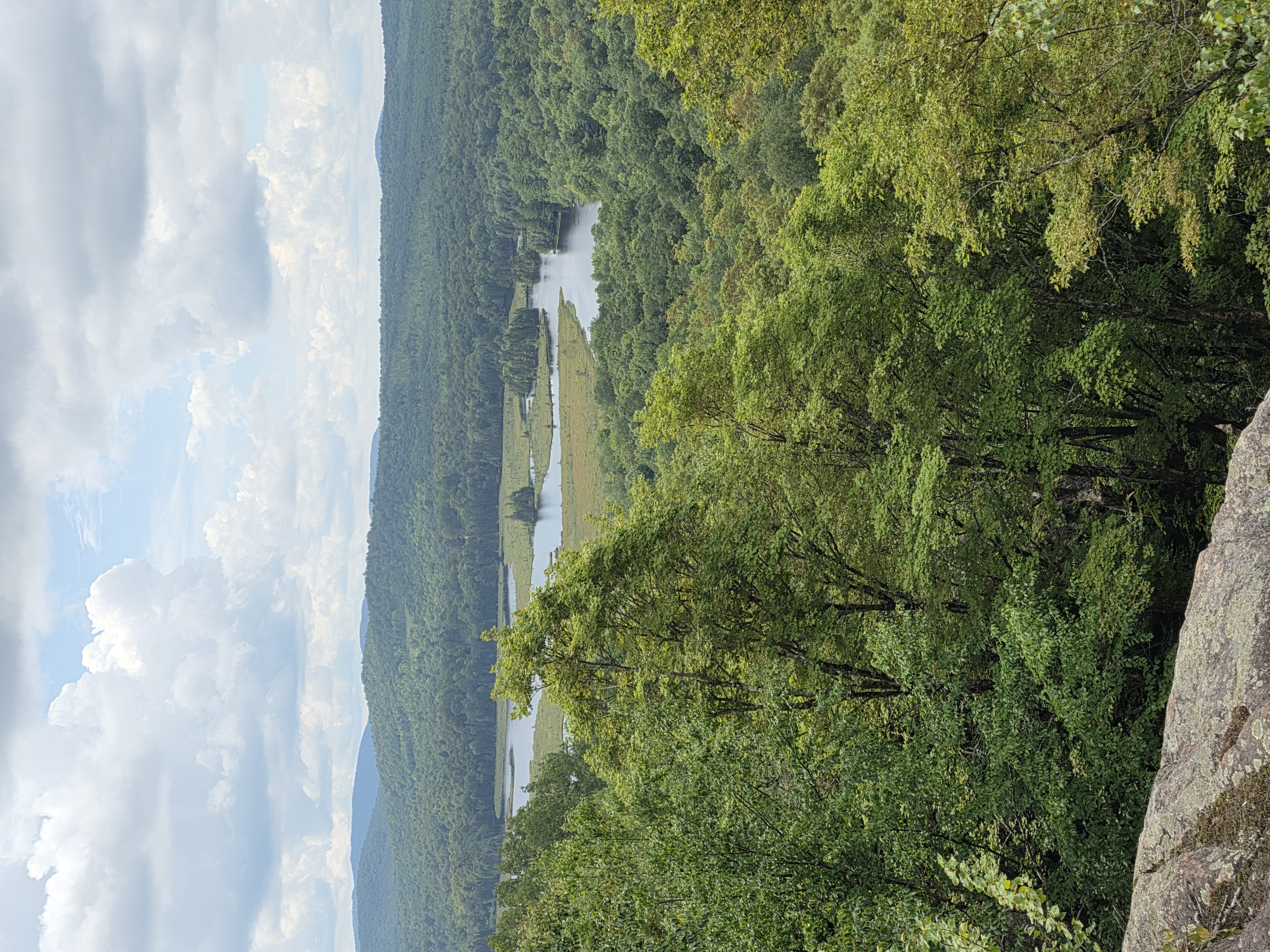
The raised water detached it. Later, a backhoe was brought in to cut a navigation channel through the altered fen.
So the landscape where the two dugouts were eventually recovered was originally more continuous with the surrounding ground than it is now.
The outlet/fen area offered a water edge directly connected to broader usable ground.
Fish taken farther upstream could be moved there.
Processing did not have to occur at the constriction where the fish were caught.
The fen and outlet therefore remain a strong place to look for the larger working landscape.
WHY THE BOATS ENDED UP THERE
The two dugouts were recovered in an outlet/fen landscape that the 1980 water rise later transformed substantially.
Their find location originally lay at an interface between navigable water, wet ground, and connected dry ground.
That does not mean it was the principal fishing location.
Wet archaeological sites preserve wood disproportionately well. A boat used elsewhere can survive where saturated, low-oxygen sediment finally takes it while evidence on nearby dry ground disappears.
One explanation is deliberate wet storage.
That practice is documented.
At Fort Niagara, a traditionally made Tuscarora-associated dugout was deliberately sunk and held underwater with rocks during winter so the wood would remain wet and resist cracking.
A late-sixteenth- or early-seventeenth-century dugout from Bethel, Connecticut, was found sunk beneath stones in deep water and has been interpreted as either winter storage or caching for later use.
That does not establish that either Twin Ponds canoe was deliberately submerged.
It establishes that the practice existed.
Natural movement remains another explanation.
So does abandonment.
And so does a distributed fishery in which the boats worked farther upstream, transported catch down through the system, and ended the season near an outlet processing or storage area.
The old attached fen makes that last possibility more interesting than the modern floating landscape first suggested.
WHERE THIS LEAVES ME
The original page began with trout.
That was enough to make the dugouts sensible.
The newer work does not replace that fishery.
It adds to it.
Greeley and Greene establish Atlantic salmon as a native, migratory, cold-water fish of this St. Lawrence region.
The historical record carries salmon into the Salmon River drainage.
Wayne Miller independently expected them in the Little Salmon and followed that river directly to the spring-fed Twin Ponds headwaters.
The StreamStats work adds topography to that chain: a continuous Little Salmon ascent, with the steepest identified reaches resolving into sustained gradient rather than an obvious major vertical barrier.
Atlantic salmon were likely using the Little Salmon River watershed and reached the Twin Ponds headwaters.
Modern telemetry demonstrates that Atlantic salmon can spend most of their freshwater migration holding in a lake below upstream spawning grounds.
Upper Twin provides that kind of cold holding water.
The old landscape then narrows movement twice.
First between Lower and Upper Twin.
Again before Spring Pond.
The August 26 field observation shows that the first of those passages was substantially tighter before the 1980 rise in water than it appears today.
Documented Indigenous fisheries show that narrow lake connections were used to intercept migrating fish and that large canoes could be working equipment within those fisheries.
The pre-1980 fen and outlet supplied a larger connected landscape downstream.
And that is where two Indigenous dugouts survived.
The Twin Ponds dugouts do not prove the salmon run. The salmon reconstruction does not prove how the dugouts were used.
But the two lines of evidence meet in the same place.
A proven trout fishery.
A likely seasonal salmon migration.
Cold holding water.
Two narrow passages.
Working ground beside them.
A larger outlet landscape.
Two Indigenous dugouts.
One nearly six meters long.
What I am looking for now is no longer simply a camp.
I am looking for the working landscape around the fishery—the places where fish were intercepted, where boats landed, where catch was moved and processed, and where people stayed while that work was being done.
The archaeological study began with a question:
“Why create such an enormous craft for use on a pond less than one kilometer wide?”
After all of this, I think the scale of the question was wrong.
It was never just one pond.
The system asked for boats.
Source Notes
Historical newspaper accounts.
The Malone Farmer, October 4, 1933, p. 5. Includes “Notable Realty Deal Completed by Malone Firm” and H. A. Kane’s “Reminiscences Of Happy Fishing Days At The Twin Ponds.” Used for descriptions of the Twin Ponds Game Preserve, Upper and Lower Twin, Little Duck Pond, Spring Pond, visible trout over white sand, lake-trout size, camps, boathouse, trails, and connected canoe travel.
Dugout canoe research.
Stager, J. Curt, David Fadden, and Christopher B. Wolff. “Dugout Canoes from Lakes of the Adirondack Uplands.” Adirondack Journal of Environmental Studies, Vol. 25. Used for the archaeological description of the two Twin Ponds dugouts, their Indigenous/traditional-tool attribution, radiocarbon age ranges, dimensions, discovery during dredging after the outlet was dammed, and the authors’ question about why such an enormous craft existed on a pond less than one kilometer wide. The article also notes that the larger craft’s size and weight suggest repeated long-term use on location rather than transient travel.
Maps.
1930 USGS topographic map used to show the pre-dam Twin Ponds system as separate connected waters. 2016 modern map used to show the post-dam impoundment and altered water shape.
Water-level calculation.
Old map elevations mark Upper Twin Pond at 1,442 feet and Lower Twin Pond at 1,443 feet. Post-dam pool information used in this project places the modern impoundment near 1,450 feet. The difference supports the calculation that the dam added roughly seven to eight feet of water over the older Spring Pond scene.
Twin Ponds fisheries reports.
Twin Ponds Preserve Fisheries Management Recommendations & Summer 2023 Water Chemistry;
Twin Ponds Preserve Spring 2024 Fisheries Report;
Twin Ponds Preserve Spring 2025 Fisheries Report;
Twin Ponds Preserve Spring 2026 Fisheries Report.
Used for the 1980 dam, pre-dam water bodies, 500-acre sphagnum bog-and-channel system phrasing, rotenone reclamation, lake-trout elimination, brook-trout stocking, Brandon Fisheries / New Brandon Fisheries references, water chemistry, modern survey stations, and modified Oneida-style trap nets.
Lake trout biology.
Fisheries and Oceans Canada — Lake Trout (Salvelinus namaycush). Used for seasonal habitat use, spawning behavior, and movement between deep holding water and shallow spawning areas.
Traditional Indigenous fishing methods.
Oneida Indian Nation — “Fishing for Life”. Used for traditional spawning-season fishing, netting, corralling, selective taking of larger fish, and community food use.
Milwaukee Public Museum — Indigenous Fishing Technologies. Used for broader regional Indigenous fishing methods including hooks and lines, nets, spears, traps, lures, bait, and canoe-supported harvest.
Modern Oneida-style trap-net source.
NYSDEC / Cornell Biological Field Station — Oneida Lake Fisheries Report. Used to distinguish “Oneida-style” / “Oneida Lake” trap-net terminology as modern fisheries sampling gear rather than proven Indigenous design lineage.
Field observations.
Author’s field observations, photographs, Creel records, Wind Ledger notes, depth estimates, Spring Pond observations, no-fishing-zone observations, and July 5, 2026 field dictation from the Twin Ponds system.
Source Notes for This Addendum
Historical Atlantic salmon abundance in New York.
Daniel J. Miller and Neil H. Ringler, Atlantic Salmon in New York, SUNY College of Environmental Science and Forestry. Used as a secondary historical synthesis for the accounts of four hundred salmon taken in one night, two thousand speared in one night, and thirty-six hundred taken by twelve skiffs. These figures establish regional historical abundance and are not used as estimates of the Twin Ponds run.
Greeley and Greene — A Biological Survey of the St. Lawrence Watershed (1931).
John R. Greeley and C. Willard Greene, “Fishes of the Area, with Annotated List,” in A Biological Survey of the St. Lawrence Watershed. Used for the survey’s inclusion of fishes “known to be present or to have been present,” Atlantic salmon’s status as a native fish of the St. Lawrence region and extinct by the survey period, its cold-water and nonresident St. Lawrence character, and the survey’s treatment of natural barriers and upstream fish distribution.
Wayne Miller — “Little Salmon River.”
Wayne Miller, “Little Salmon River”. Miller grew up along the Little Salmon near Brushton and wrote that he expected Atlantic salmon had once occupied the river. In the following sentence he identifies Twin Ponds as the river’s headwater origin and describes the spring-fed upper waters as good salmon and trout spawning habitat. His statement is used as informed local inference, not as a primary historical salmon record.
Little Salmon / Salmon River watershed.
Local and fisheries sources document the Little Salmon as part of the Franklin County Salmon River drainage and place its headwaters at Twin Ponds. The Franklin County Salmon River is also described in official local-government fisheries history as having once supported Atlantic salmon runs; the underlying pre-extirpation primary source for that statement has not yet been recovered.
USGS StreamStats — Little Salmon River.
USGS StreamStats basin report and longitudinal elevation profiles prepared August 27, 2026. Used for the Little Salmon’s perennial-stream designation, approximately 14.2-mile main-channel length, 10–85 percent main-channel slope of about 57 feet per mile, upper-half slope of about 37 feet per mile, and examination of the two steepest-looking reaches. The profiles show sustained gradient and short rapid-like rises rather than an obvious major waterfall-scale vertical break. Historical logging, dams, channel work, and later impoundments prevent the modern profile from being treated as an exact reconstruction of the pre-contact channel.
Lough Feeagh Atlantic salmon telemetry.
Research from the Burrishoole system in Ireland documenting wild Atlantic salmon migrating toward spawning grounds above Lough Feeagh. Tagged adults averaged approximately 228 days in freshwater and spent about 90 percent of that time in the lake, with strong use near the principal inflow and deeper, cooler water during warm conditions. Used only as direct biological evidence that Atlantic salmon can use a freshwater lake on a spawning migration route as prolonged holding water; it is not an Indigenous-fishery comparison.
Babine–Nilkitkwa salmon fisheries.
Archaeological and ethnographic documentation of Indigenous salmon interception in the Babine–Nilkitkwa system at narrow lake outlets and constrictions using weirs, traps, spears, nets, and canoes, with controlled passage upstream and differentiated capture, processing, storage, and residential areas. Used as a functional comparison for the mechanics of narrow-water interception and separation of capture from larger working ground.
Mnjikaning / Atherley Narrows fish weirs.
Parks Canada documentation of the Mnjikaning Fish Weirs, including long-term Indigenous wooden-weir construction in the shallow constriction between two glaciated lakes in Ontario. Used as an eastern geographic and structural comparison for repeated fishing use of a narrow lake-to-lake passage; it is not an Atlantic-salmon-specific comparison.
Harrison River salmon fishery.
Hilary Stewart, Indian Fishing: Early Methods on the Northwest Coast. Ethnohistorical documentation of a very large dugout canoe used directly by a crew spearing salmon on the Harrison River. Used to establish that large dugouts could function as working salmon-fishing craft; it does not assign a specific function to either Twin Ponds canoe.
Oxbow / Metepenagiag, New Brunswick.
Parks Canada documentation of Oxbow National Historic Site records roughly three thousand years of repeated Mi’kmaq occupation at an important fishing locality on the Northwest Miramichi, including numerous hearths, while Atlantic salmon remained an important food fishery for the community. Used for the spatial relationship between productive fishing water, repeated occupation, hearths, and processing ground, not as a population-scale comparison with Twin Ponds.
Indian Carry, Upper Saranac Lake.
Historical accounts document repeated Indigenous seasonal occupation at the carry between Upper Saranac Lake and Stony Creek Ponds, including hunting and fishing along a connected Adirondack water route. Used as a regional comparison for repeated working occupation associated with connected waters.
Dugout wet storage.
A traditionally made Tuscarora-associated dugout at Fort Niagara was deliberately sunk and weighted underwater during winter to keep the wood wet and reduce cracking. A late-sixteenth- or early-seventeenth-century dugout from Bethel, Connecticut, was found sunk beneath stones and has been interpreted as winter storage or caching. Used only to establish that deliberate submerged storage of dugouts is documented; neither example determines the depositional history of the Twin Ponds boats.
1930 topographic map and August 26, 2026 field observations.
The 1930 map shows the broad eastern bench/peninsula at the Lower Twin–Upper Twin neck as dry land. August 26 field observations located the same landform beneath the modern impoundment and identified the surviving deep channel against the western shore, estimated at approximately five to seven yards wide. The annotated map used in this addendum marks the Lower–Upper constriction, the former eastern bench/peninsula, and the Upper Twin–Spring Pond constriction.